


Newaygo, Mason, Oceana & Lake Counties PUMA, Michigan
About
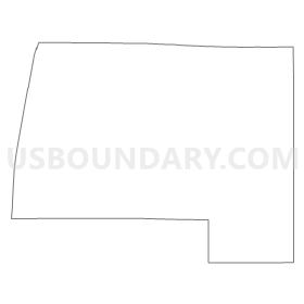
Outline
Summary
| Unique Area Identifier | 193148 |
| Name | Newaygo, Mason, Oceana & Lake Counties PUMA |
| State | Michigan |
| Area (square miles) | 3,984.36 |
| Land Area (square miles) | 2,387.72 |
| Water Area (square miles) | 1,596.64 |
| % of Land Area | 59.93 |
| % of Water Area | 40.07 |
| Latitude of the Internal Point | 43.78161100 |
| Longtitude of the Internal Point | -86.29397100 |
Maps


Graphs
Select a template below for downloading or customizing gragh for Newaygo, Mason, Oceana & Lake Counties PUMA, Michigan


Neighbors
Neighoring Public Use Microdata Area (by Name) Neighboring Public Use Microdata Area on the Map
- Ionia, Montcalm, Mecosta & Osceola Counties PUMA, MI
- Kent County (North) PUMA, MI
- Manitowoc & Kewaunee Counties PUMA, WI
- Muskegon County PUMA, MI
- Northwest Lower Peninsula (East) PUMA, MI
- Northwest Lower Peninsula (West) PUMA, MI
- Sheboygan County PUMA, WI
- Washington & Ozaukee Counties PUMA, WI
Top 10 Neighboring County (by Population) Neighboring County on the Map
- Kent County, MI (602,622)
- Muskegon County, MI (172,188)
- Sheboygan County, WI (115,507)
- Ozaukee County, WI (86,395)
- Manitowoc County, WI (81,442)
- Montcalm County, MI (63,342)
- Newaygo County, MI (48,460)
- Mecosta County, MI (42,798)
- Wexford County, MI (32,735)
- Mason County, MI (28,705)
Top 10 Neighboring County Subdivision (by Population) Neighboring County Subdivision on the Map
- Egelston township, Muskegon County, MI (9,909)
- Ludington city, Mason County, MI (8,076)
- Solon township, Kent County, MI (5,974)
- Reynolds township, Montcalm County, MI (5,310)
- Tyrone township, Kent County, MI (4,731)
- Big Rapids charter township, Mecosta County, MI (4,208)
- Fremont city, Newaygo County, MI (4,081)
- Shelby township, Oceana County, MI (4,069)
- Brooks township, Newaygo County, MI (3,510)
- Hamlin township, Mason County, MI (3,408)
Top 10 Neighboring Place (by Population) Neighboring Place on the Map
- Ludington city, MI (8,076)
- Fremont city, MI (4,081)
- Hart city, MI (2,126)
- Shelby village, MI (2,065)
- Newaygo city, MI (1,976)
- White Cloud city, MI (1,408)
- Scottville city, MI (1,214)
- Baldwin village, MI (1,208)
- Hesperia village, MI (954)
- Grant city, MI (894)
Top 10 Neighboring Elementary School District (by Population) Neighboring Elementary School District on the Map
Top 10 Neighboring Unified School District (by Population) Neighboring Unified School District on the Map
- Cadillac Area Public Schools, MI (21,237)
- Cedar Springs Public Schools, MI (19,294)
- Big Rapids Public Schools, MI (18,956)
- Ludington Area School District, MI (15,954)
- Fremont Public School District, MI (13,641)
- Tri County Area Schools, MI (13,390)
- Manistee Area Schools, MI (12,921)
- Whitehall School District, MI (11,811)
- Reed City Area Public Schools, MI (10,776)
- Newaygo Public School District, MI (10,339)
Top 10 Neighboring State Legislative District Lower Chamber (by Population) Neighboring State Legislative District Lower Chamber on the Map
- State House District 73, MI (105,447)
- State House District 102, MI (99,061)
- State House District 101, MI (92,671)
- State House District 91, MI (90,216)
- State House District 70, MI (89,992)
- State House District 100, MI (86,569)
- Assembly District 2, WI (61,009)
- Assembly District 59, WI (58,836)
- Assembly District 60, WI (57,434)
Top 10 Neighboring State Legislative District Upper Chamber (by Population) Neighboring State Legislative District Upper Chamber on the Map
- State Senate District 28, MI (306,724)
- State Senate District 34, MI (275,923)
- State Senate District 33, MI (272,940)
- State Senate District 35, MI (261,943)
- State Senate District 1, WI (180,989)
- State Senate District 20, WI (176,381)
Top 10 Neighboring 111th Congressional District (by Population) Neighboring 111th Congressional District on the Map
- Congressional District 2, MI (698,831)
- Congressional District 3, MI (694,695)
- Congressional District 4, MI (686,378)
Top 10 Neighboring Census Tract (by Population) Neighboring Census Tract on the Map
- Census Tract 9705, Montcalm County, MI (7,705)
- Census Tract 103, Oceana County, MI (7,045)
- Census Tract 9607, Mecosta County, MI (6,454)
- Census Tract 106, Oceana County, MI (5,703)
- Census Tract 103.02, Kent County, MI (5,427)
- Census Tract 9704, Newaygo County, MI (5,187)
- Census Tract 9706, Montcalm County, MI (5,186)
- Census Tract 33, Muskegon County, MI (5,095)
- Census Tract 103.01, Kent County, MI (5,088)
- Census Tract 9710, Newaygo County, MI (5,059)
Top 10 Neighboring 5-Digit ZIP Code Tabulation Area (by Population) Neighboring 5-Digit ZIP Code Tabulation Area on the Map
- 49601, MI (21,236)
- 49307, MI (20,112)
- 49431, MI (16,875)
- 49319, MI (16,181)
- 49660, MI (14,066)
- 49337, MI (12,088)
- 49412, MI (11,065)
- 49457, MI (10,565)
- 49329, MI (8,641)
- 49327, MI (8,406)